| ![Show Contents]() Convay History, Family Crest & Coats of Arms Convay History, Family Crest & Coats of Arms
- Origins Available:
Ireland
Etymology of ConvayWhat does the name Convay mean? All Irish surnames have a long, ancient Gaelic history behind them. The original Gaelic form of the name Convay is Ó Conbhuidhe or Ó Connmhachain. The former of these names likely comes from the Gaelic word "condmach," while the latter probably comes from "cu buidhe." 1 Conway is also an Anglicization of the names Mac Conmheadha or Mac Connmhaigh. One of the first records of the family was Gillabrighde MacConmidhe (fl. 1260) the Irish "historian and poet, a member of a family which for more than three centuries acted as hereditary poets of the Cinel Eoghain, the O'Neills, and their kindred septs. He was born about 1200, and wrote a poem on Cathal Croibhdhearg O'Conor during the lifetime of that king, who died in 1224. Brian O'Neill, chief of the Cinel Eoghain, once gave him twenty horned cows (fiche bo bheannach) for poem, and on another occasion, after the feativities of May day, gave him twenty cows, besides gold and clothing." 2 He was the progenitor of a long line of early Irish poets that were known into the mid 16th century. Early Origins of the Convay familyThe surname Convay was first found in Donegal (Irish: Dún na nGall), northwest Ireland in the province of Ulster, sometimes referred to as County Tyrconnel, and Connacht. The name is "the anglicized form of several different Irish surnames." 3 The name MacConway (McConway) was typically found in Donegal while the name Conway was found in nearby Sligo in the parish of Easky. 3 Early History of the Convay familyThis web page shows only a small excerpt of our Convay research. Another 143 words (10 lines of text) covering the years 1300, 1360, 1420, 1434, 1493, 1507, 1542, 1564, 1583, 1586, 1594, 1607, 1623, 1628, 1630, 1631, 1655, 1661, 1669, 1679, 1681 and 1683 are included under the topic Early Convay History in all our PDF Extended History products and printed products wherever possible. Convay Spelling VariationsDuring the Middle Ages, a standardized literary language known by the general population of Ireland was a thing of fiction. When a person's name was recorded by one of the few literate scribes, it was up that particular scribe to decide how to spell an individual's name. So a person could have several spelling variations of his name recorded during a single lifetime. Research into the name Convay revealed many variations, including Conway, Conboy, Convey, O'Conway, McConway and others. Early Notables of the Convay familyProminent amongst the family at this time was Edward Conway, 1st Viscount Conway PC (1564-1631), an English soldier and statesman, Secretary of State in 1623, Lord President of the Council (1628-1631); his son, Edward Conway, 2nd Viscount Conway PC (1594-1655), an English politician, military commander and peer; and his son, Edward Conway, 1st Earl of Conway PC...
Another 56 words (4 lines of text) are included under the topic Early Convay Notables in all our PDF Extended History products and printed products wherever possible. Migration of the Convay familyThousands of Irish left in their homeland in the 18th and 19th centuries to escape the religious and political discrimination they experienced primarily at the hands of the English, and in the search of a plot of land to call their own. These immigrants arrived at the eastern shores of North America, early on settling and breaking the land, and, later, building the bridges, canals, and railroads essential to the emerging nations of United States and Canada. Many others would toil for low wages in the dangerous factories of the day. Although there had been a steady migration of Irish to North America over these years, the greatest influx of Irish immigrants came to North America during the Great Potato Famine of the late 1840s. Early North American immigration records have revealed a number of people bearing the Irish name Convay or a variant listed above: Edwin Conway of Worcestershire, England, who settled in the year 1645 in Virginia. From him was descended Mary Ball, the mother of George Washington.
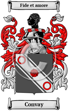
The motto was originally a war cry or slogan. Mottoes first began to be shown with arms in the 14th and 15th centuries, but were not in general use until the 17th century. Thus the oldest coats of arms generally do not include a motto. Mottoes seldom form part of the grant of arms: Under most heraldic authorities, a motto is an optional component of the coat of arms, and can be added to or changed at will; many families have chosen not to display a motto.
Motto: Fide et amore
Motto Translation: By fidelity and love.
- MacLysaght, Edward, The Surnames of Ireland. Ireland: Irish Academic Press, sixth edition, 1985. Print. (ISBN 0-7165-2366-3)
- Smith, George (ed), Dictionary of National Biography. London: Smith, Elder & Co., 1885-1900. Print
- MacLysaght, Edward, Irish Families Their Names, Arms and Origins 4th Edition. Dublin: Irish Academic, 1982. Print. (ISBN 0-7165-2364-7)
 |